8 Best Hikes in Barcelona: Collserola Trails and City Hills
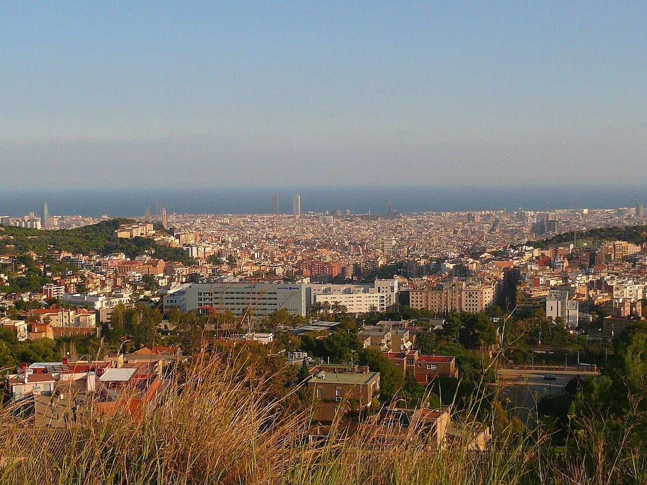
The best hike in Barcelona for most visitors is also the easiest one in this guide: the Carretera de les Aigües, a flat dirt track that runs for about 9 km along the Collserola hillside some 300 metres above the city — no real climbing, the whole skyline spread out in front of you, and a funicular stop in the middle for an easy way down. If you only walk one route while you’re here, make it that one.
What surprises most people is how much real hiking Barcelona holds. Behind the city rises the Serra de Collserola, a protected natural park of more than 8,000 hectares of pine and holm-oak forest with some 350 km of signposted paths, and every trailhead in this guide is reached by metro, FGC train or Rodalies — no car, no tour bus, no early alarm unless you want the sunrise. Inside the city itself, three green hills and the castle rock of Montjuïc give you shorter walks with the same payoff.
These are the eight routes we’d send a friend on, ordered from the gentlest skyline stroll to a proper ridge walk. If viewpoints are the whole point of your trip, pair this guide with our round-up of the best views in Barcelona — several of them are earned on foot below.
In This Guide
- 1. Carretera de les Aigües: Barcelona’s Flat Skyline Walk
- 2. Baixador de Vallvidrera to Tibidabo: The Summit Hike
- 3. Sant Cugat to Sant Medir: The Forest Chapel Loop
- 4. The Three Hills: Parc del Guinardó, the Bunkers and Creueta del Coll
- 5. Montjuïc: Castle and Gardens Above the Port
- 6. Vallvidrera Reservoir and Vil·la Joana: The Gentle One
- 7. Besòs River Park: The Flat Riverside
- 8. Sant Pere Màrtir: The Ridge Above Esplugues
- Further Afield: Montserrat, the Hiker’s Day Trip
- Good to Know Before You Lace Up
- Final Thoughts
1. Carretera de les Aigües: Barcelona’s Flat Skyline Walk
Best for: a first hike, tired legs, sunset
Start / finish: Pla dels Maduixers (north-east end) to Plaça Mireia (south-west end) — or join halfway at the Carretera de les Aigües stop of the Funicular de Vallvidrera
Distance: about 9 km end to end
Climb: almost none — the track holds one contour the whole way
Difficulty: Easy
The Carretera de les Aigües — the “Water Road” — was built as a service track for a pipeline that carried water across the hillside from a cistern near Sant Pere Màrtir. The pipes are long gone, and what’s left is the finest easy walk in Barcelona: a wide, flat dirt road pinned to the slope at about 300 metres, with the city laid out below you from start to finish. On a clear day you can pick out the Torre Glòries, the Sagrada Família, the harbour cranes and the line of the sea, and the track just unrolls ahead — no navigation, no steep bits, no way to get it wrong.
That’s why half of Barcelona seems to be up here at weekends: runners, dog walkers, mountain bikers and grandparents with pushchairs all share the same track, and it never feels crowded because it’s nine kilometres long. Walk as much or as little as you like. The easiest taster is to ride the FGC to Peu del Funicular, take the Funicular de Vallvidrera one stop up to its Carretera de les Aigües halt, and stroll either way from there.
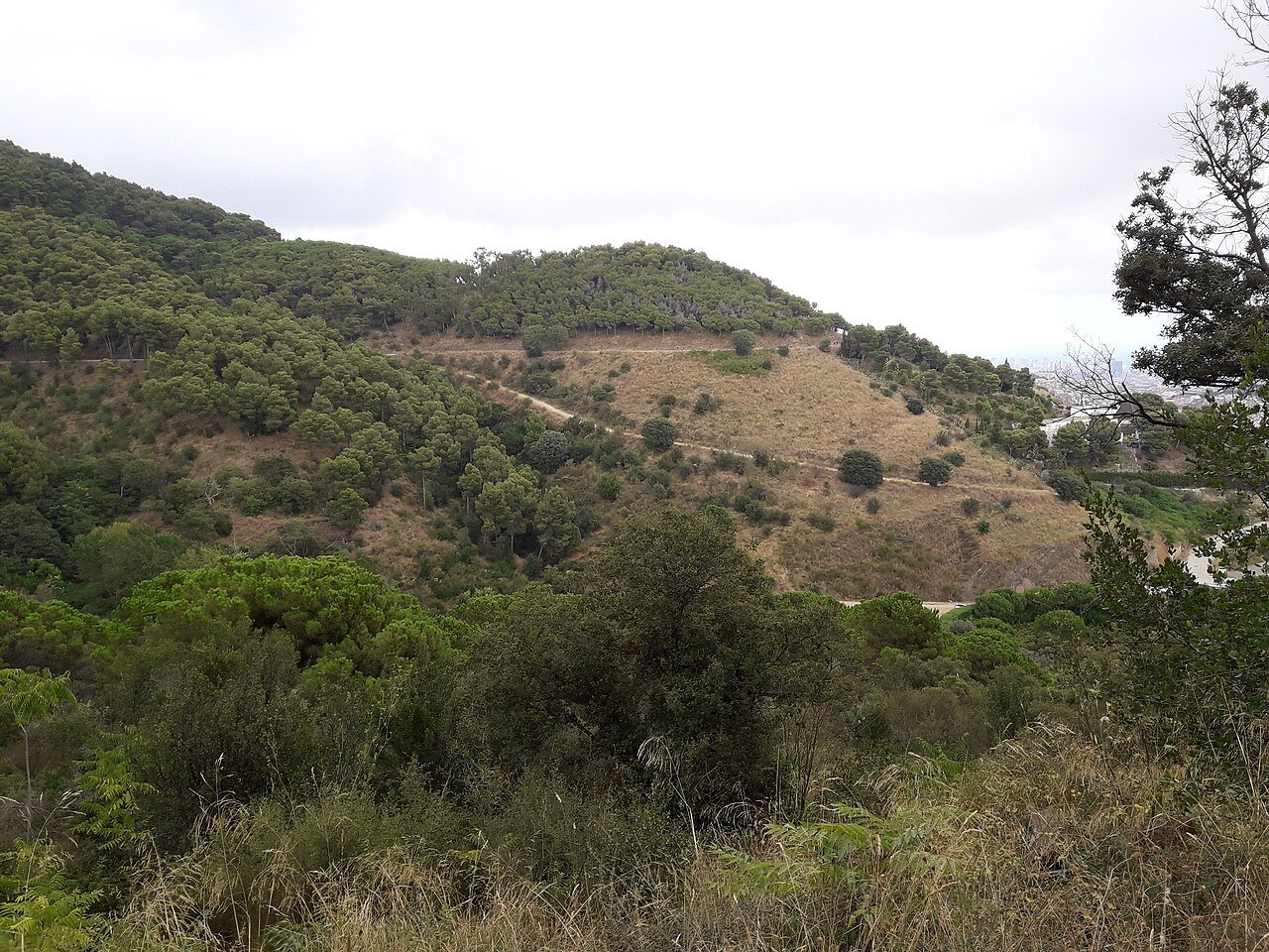
Heading south-west, the track ends at Plaça Mireia above Esplugues, where the Espai Mireia bar waits at exactly the moment you want a cold drink. Heading north-east, you finish at Pla dels Maduixers, a short walk from Avinguda Tibidabo and its metro station. Two honest warnings: there is no water anywhere along the route, so carry a bottle, and the hillside faces the sun — in summer, come early in the morning or in the last two hours of light, when the city below turns gold.
2. Baixador de Vallvidrera to Tibidabo: The Summit Hike
Best for: the classic Collserola climb — forest below, the whole city on top
Start: Baixador de Vallvidrera station (FGC lines S1/S2)
Distance: about 4.5 km one way
Climb: about 250 m, up to the 512 m summit
Time: about 2 hours up, following the park’s signposted walk
Difficulty: Moderate — a steady uphill, never steep
Every city should have a mountain you can climb straight off a commuter train, and Tibidabo is Barcelona’s. From Baixador de Vallvidrera station, lanes lead past the house-museum of Vil·la Joana and the Collserola information centre — worth a stop for the free park map — and then the white-and-red waymarks of the park’s Tibidabo walk take over, winding up through holm oak and pine. It’s a real forest path, shaded almost the whole way, and the only sounds are birds and your own footsteps.
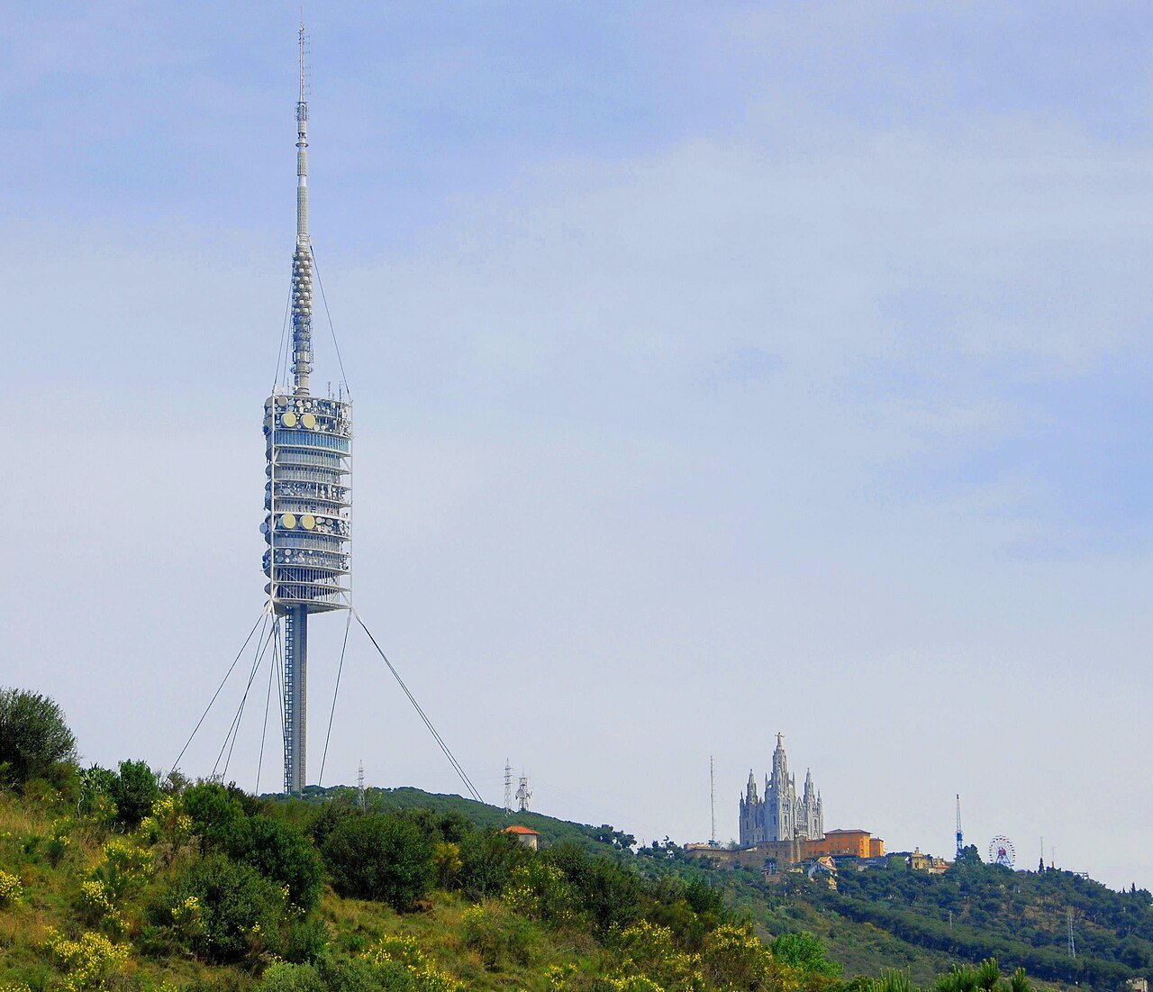
Near the top you pass the Torre de Collserola, Norman Foster’s 288-metre communications needle built for the 1992 Olympics, and then the summit opens out all at once: the church of the Sagrat Cor on the very top, the old-fashioned amusement park beside it, and a 360-degree view that takes in the whole city, the sea and, on clear winter days, the Pyrenees. Ride the Funicular del Tibidabo down to Plaça del Doctor Andreu afterwards, then the vintage Tramvia Blau tram or bus 196 to Avinguda Tibidabo station — or walk back down through the trees if your knees are feeling generous. Our separate guide to Tibidabo covers the church, the park and the funicular in full.
Prefer it guided? The Tibidabo Sunrise + Local Breakfast with Views walk climbs the same mountain the slow way — a private-group, roughly four-hour hike from the Horta side with a picnic breakfast of pa amb tomàquet, cold cuts and coffee at the top, with free cancellation and reserve now, pay later. It’s a new activity, so you’re booking the idea rather than a wall of reviews — but sunrise over the city with breakfast waiting is quite an idea.
3. Sant Cugat to Sant Medir: The Forest Chapel Loop
Best for: deep shade, Collserola at its greenest, a picnic in a hermitage clearing
Start / finish: Sant Cugat station (FGC), looping back to the same station
Distance: 11.8 km circular — the official town route
Difficulty: Moderate
If the Carretera de les Aigües is Collserola’s balcony, this is its interior. Sant Cugat del Vallès, a short FGC ride from Plaça de Catalunya, sits on the park’s northern side, and its town hall publishes a waymarked circular walk that follows the GR 6 long-distance path up the wooded valley of the Sant Medir stream. Within minutes the town is gone and you’re walking in the deepest, shadiest forest in the park — the side of Collserola that stays green and cool longest into summer.
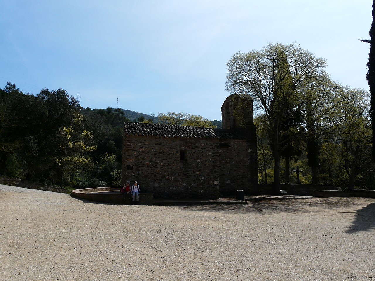
The route passes the Pi d’en Xandri, a huge stone pine that has stood over the valley for generations, then the old masia of Can Borrell with its small reservoir, before climbing gently to the walk’s heart: the hermitage of Sant Medir, a plain stone Romanesque chapel documented since 962, standing in a big grassy clearing with a fountain and picnic tables. On 3 March the clearing fills for the Aplec, the traditional pilgrimage festival — any other day, you may have it nearly to yourself. The loop returns by the little shrine of Sant Adjutori. The neighbouring valleys hide more of the park’s secrets, including the Font Groga, an iron-rich spring whose ochre water has stained its ravine yellow — part of a protected nature reserve, and a good excuse to come back.
4. The Three Hills: Parc del Guinardó, the Bunkers and Creueta del Coll
Best for: the best city hike in Barcelona — three summits, zero transport out of town
Start: Guinardó | Hospital de Sant Pau (metro L5) or Alfons X (L4)
Distance: about 9.9 km point to point
Climb: about 427 m in total, spread over three separate hills
Difficulty: Easy, with three short climbs
Barcelona’s eastern skyline is a chain of three green hills, and linking them makes the best purely urban hike in the city. Start in the pine woods of Parc del Guinardó and climb first to the Turó de la Rovira (262 m), better known by its nickname: the Bunkers del Carmel. They were never bunkers at all — the concrete circles are a Civil War anti-aircraft battery, completed in March 1938, and the site is now protected as a museum space by MUHBA. The 360-degree panorama is the one every visitor photographs, but go in the morning if you can: by sunset the platforms fill up, and the site is now fenced and keeps daytime hours, so there’s no staying for the night view any more. We tell the battery’s full story — including the shantytown that covered the hill after the war — in our guide to the Bunkers del Carmel.
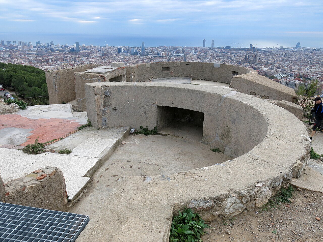
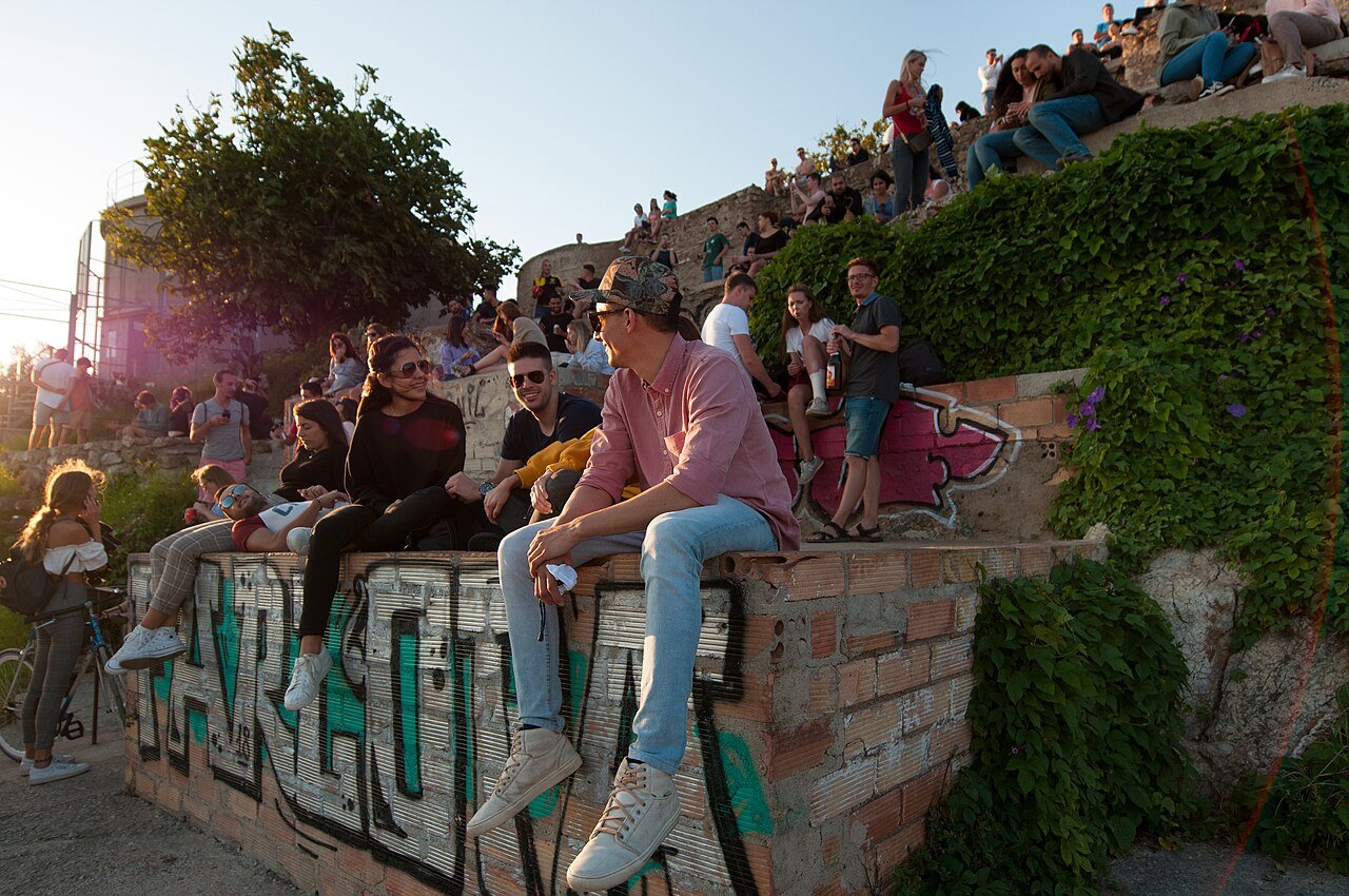
From the Rovira, a footbridge crosses to the second hill, the Turó del Carmel (265 m), the quietest of the three, and the way down passes through the free forest zone of Park Güell — the ticketed monumental core sits inside it, and our Park Güell guide explains what’s free and what isn’t. The walk finishes in the green bowl of Parc de la Creueta del Coll, under the third and lowest hill (245 m). Three summits, two famous sights and a whole cross-section of the city, all on foot from a metro station.
5. Montjuïc: Castle and Gardens Above the Port
Best for: an in-city hill walk with gardens, Olympic history and a castle
Start: Plaça d’Espanya (metro L1/L3)
Height: the castle tops the hill at 173 m
Time: about 45 minutes to an hour up on foot
Difficulty: Easy
Montjuïc is the hill Barcelona has been climbing for a century of exhibitions and Olympics, and walking up it beats the cable car. From Plaça d’Espanya, the outdoor escalators beside the Magic Fountain do the first stretch for you, up to the Palau Nacional; then the route winds on past the 1992 Olympic Stadium and through a string of gardens — the open-air Teatre Grec theatre, the fountains of Laribal, the modern botanical garden (opened in 1999) and, on the sea-facing side, a whole hillside of cacti at the Mossèn Costa i Llobera gardens.
At the top stands Montjuïc Castle, whose terraces look straight down the harbour. The fortress has a dark side — in 1842 its guns bombarded the city below — but today the ramparts are a peaceful place to watch the port and the cruise ships. If the climb sounds like enough walking for one day, come down the lazy way: the Telefèric cable car to the funicular, or bus 150, which runs from the castle back to Plaça d’Espanya.

6. Vallvidrera Reservoir and Vil·la Joana: The Gentle One
Best for: families, a slow half-day, walkers who like a museum with their nature
Start: Baixador de Vallvidrera station (FGC lines S1/S2)
Difficulty: Easy — lanes and flat paths around the water
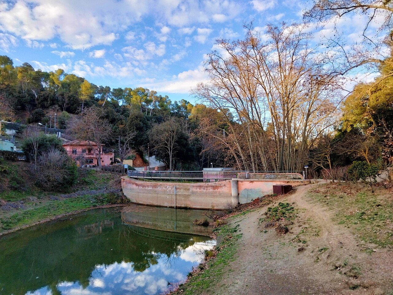
Not every hike needs a summit. Ten minutes on foot from Baixador de Vallvidrera station stands Vil·la Joana, the farmhouse where the poet Jacint Verdaguer spent his last days in 1902 — now a small, free MUHBA house-museum — and just beyond it, the Collserola information centre. From there, gentle lanes lead to the Pantà de Vallvidrera, the little reservoir built between 1850 and 1864 to supply Sarrià with water: a curved brick dam designed by Elies Rogent, hidden in the woods at the head of a green valley.
The water fell out of use by 1960 and the reservoir was restored in 2005–06 as a nature and leisure area — today it’s a calm, duck-dotted pond ringed by paths, with the 1.5 km Mina Grott tunnel (bored in 1855 to carry its water to Sarrià) as the engineering curiosity on the way. There’s no measured “route” here and that’s the point: link the museum, the information centre, the dam wall and the shady far bank at whatever pace the day suggests.
7. Besòs River Park: The Flat Riverside
Best for: a long, completely flat walk or run — the Carretera’s lowland twin
Start: Sant Adrià de Besòs station (Rodalies)
Distance: 9.7 km one way to Montcada i Reixac, or about 5 km of grassed park if you turn back at Can Zam
Climb: 25 m — effectively none
Time: about 2 to 2.5 hours end to end
Difficulty: Easy
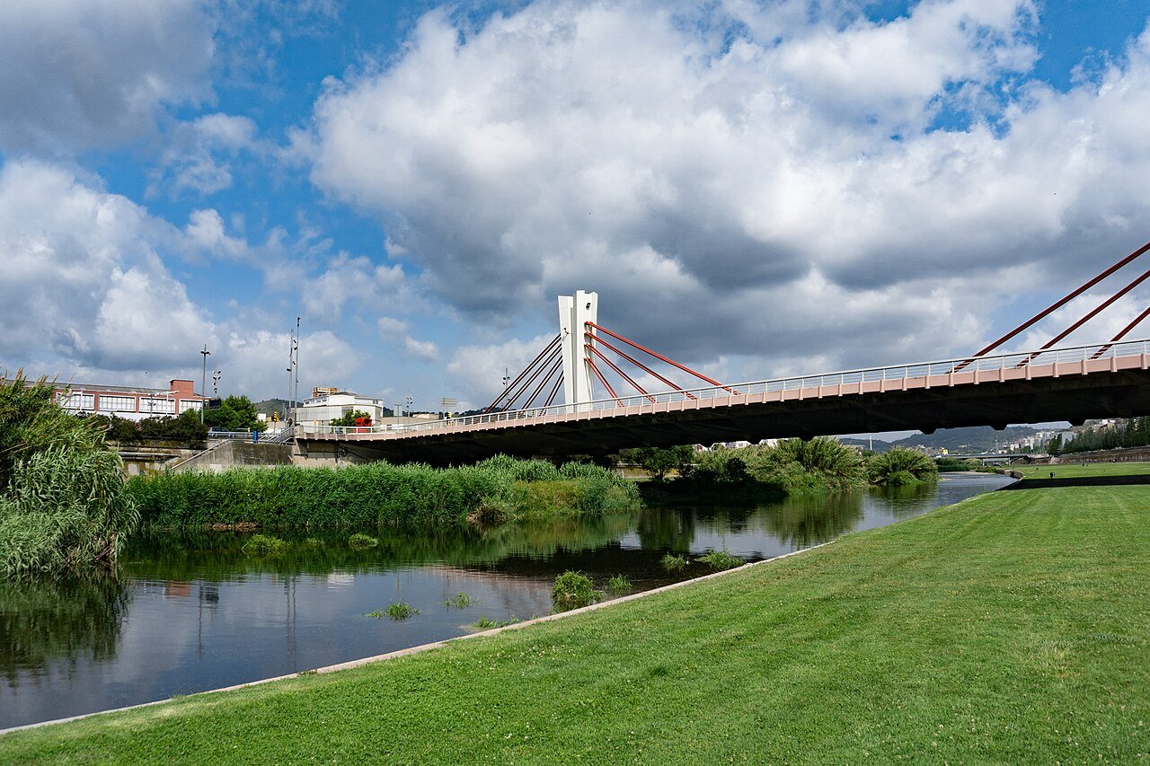
Barcelona’s other river walk couldn’t be more different from the Carretera de les Aigües: same idea — a long, flat line through green space — but at sea level, on grass, beside running water. The Parc Fluvial del Besòs follows the last stretch of the Besòs river, and the GR 92 path runs its length on a paved track between lawns that Sant Adrià and Santa Coloma treat as their beach-without-a-sea. The public stretch runs for about 5 km from the railway bridge at Sant Adrià to the Can Zam bridge; the full riverside line continues to Montcada i Reixac, from where the train brings you back.
The park is also a quiet environmental success story. Within living memory the Besòs was an open sewer; today fish populations have been stable in it since 2007, herons patrol the shallows, and a protected upstream stretch holds 7.6 hectares of constructed wetlands that polish part of the Montcada treatment plant’s water (that section is closed to walkers — admire it from the path). Be honest with yourself about what this is: open, sunny and short on shade, it’s a locals’ exercise loop rather than a beauty spot. But for a flat, car-free, by-the-water walk ten minutes from the centre, nothing else in the city comes close.
8. Sant Pere Màrtir: The Ridge Above Esplugues
Best for: a longer, quieter ridge walk that builds on walk 1
Start: Plaça Mireia, at the south-western end of the Carretera de les Aigües (or from Vallvidrera)
Distance: 10.1 km linear on the recorded ridge route to La Miranda
Difficulty: Moderate
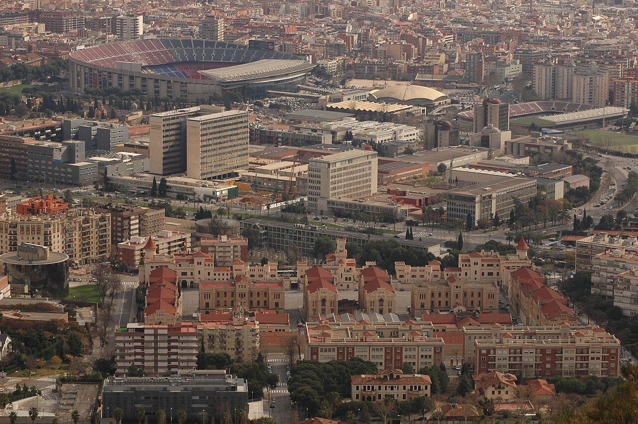
When the Carretera de les Aigües ends at Plaça Mireia, most walkers turn back — and miss the best climb in the south-western corner of the park. From the square, paths rise past the Mirador dels Xiprers viewpoint to Sant Pere Màrtir, a wooded crest where a small 17th-century sanctuary once stood; today there’s a picnic area, stone pines and the kind of double view the Carretera can’t give you — south-west over Esplugues and the Llobregat plain, north-east back across the whole city, with Camp Nou sitting below you like a model.
The recorded ridge route runs 10.1 km from Vallvidrera past Sant Pere Màrtir to the La Miranda viewpoint, and it links naturally with walk 1: ride up, stroll the Carretera to Plaça Mireia, climb the crest, and descend with the day’s work done. This is proper Collserola path-walking rather than a promenade — narrower tracks, no reliable water anywhere on the ridge — so carry everything you’ll drink and give it the cooler hours of the day.
Further Afield: Montserrat, the Hiker’s Day Trip
One mountain is deliberately missing from the routes above. Montserrat — the serrated ridge and monastery an hour from the city — is a day trip in its own right, not a Barcelona hike, and it already has a full guide on this site: our Montserrat Monastery article covers getting there by train and rack railway, the basilica and the trails above it. If you’d rather have the hiking organised, two guided versions stand out:
- From Barcelona: Montserrat Monastery, Easy Hike, Cable Car — the easy option: six hours, a small group, a certified mountain guide, the monastery and its cloister, a cable car up and a gentle 50-minute hike on top. Rated 4.9/5 from 1,349 reviews, from $78 per person, with free cancellation and reserve now, pay later.
- From Barcelona: Montserrat Full-Day Trip with Guided Hike — the hiker’s option: a full 9.5-hour day with about 11 km of guided hiking in a group of no more than eight, the Sant Joan funicular up, the monastery and a picnic lunch included. Rated 5.0/5 from 50 reviews, with free cancellation and reserve now, pay later.
Good to Know Before You Lace Up
- Best seasons are spring and autumn. Collserola is walkable all year, but in July and August treat the hills like a Mediterranean mountain: start at dawn, be down by late morning, and keep the flat, exposed routes (walks 1, 7 and 8) for the evening.
- Water is the one thing to plan. There are fountains at picnic areas, villages and the Collserola information centre, but the Carretera de les Aigües and the Sant Pere Màrtir ridge have none at all. Carry at least a litre per person, more in summer.
- Follow the colours. The park maintains some 350 km of signposted itineraries; white-and-red marks are the GR long-distance paths, and each trailhead board shows a map — photograph it before you set off. Collserola is a protected natural park, so stay on the marked paths.
- Every trailhead is on the integrated network. FGC, metro and Rodalies all take the same travel cards, so a T-casual or a multi-day pass covers every start point in this guide — our Spain travel tips explain the ticket types.
- Footwear can stay light. Trainers are fine for walks 1, 5, 6 and 7; for the forest paths of walks 2, 3 and 8, wear something with grip — the Collserola tracks are dusty and slippery after rain.
- Check before you go in high summer. On the highest fire-risk days the park issues warnings and can restrict access; a quick look at the Collserola park website (parcnaturalcollserola.cat) the night before is a sensible habit.
Travel insurance, sorted
Whether it is a two-week holiday or a longer move, travel insurance is not the most glamorous part of a trip – but it is the one booking you want to have in place before a trip, and while you are already away. Get a quote from SafetyWing
Final Thoughts
Barcelona rewards anyone willing to walk uphill a little. The Carretera de les Aigües gives you the whole city for almost no effort, Tibidabo gives you a summit off a suburban train, and the Three Hills give you a proper hike without leaving the metro map — and all of it is free, signposted and an hour or less from your hotel. Pick one route, start early, and you’ll understand the city better by lunch than a week of sightseeing would manage. If the rest of your trip is museums and landmarks, our guide to the best pass for Barcelona will help you sort the sightseeing side just as efficiently.

5 Best Passes for Barcelona: Which One Is Actually Worth It?
Frequently Asked Questions
What is the easiest hike in Barcelona?
The Carretera de les Aigües (walk 1). It’s a flat, wide dirt track about 9 km long at roughly 300 metres above the city — no climbing, no navigation — and the Funicular de Vallvidrera stops halfway along it, so you can walk a short section and ride down.
Can you go hiking in Barcelona without a car?
Yes — every route in this guide starts at a metro, FGC or Rodalies station. Baixador de Vallvidrera (FGC S1/S2) is the gateway for the Tibidabo and reservoir walks, Sant Cugat station for the Sant Medir loop, and Sant Adrià de Besòs (Rodalies) for the river park.
How long does it take to hike up Tibidabo?
About two hours from Baixador de Vallvidrera station, following the park’s signposted walk — roughly 4.5 km with about 250 m of climbing. If you’d rather save your legs, the funicular and Tramvia Blau get you to the top without breaking a sweat.
When is the best time of year to hike in Barcelona?
Spring (March to May) and autumn (October and November) are ideal — green hills, mild temperatures and clear views. Summer hiking is fine if you start at dawn and carry plenty of water; winter days are often crisp and excellent for views.
Do I need hiking boots for these walks?
No. Trainers are fine for the Carretera de les Aigües, Montjuïc, the reservoir and the Besòs river park. For the Collserola forest paths to Tibidabo, Sant Medir and Sant Pere Màrtir, choose shoes with decent grip, especially after rain.
Are the Collserola trails well marked?
Yes. The natural park maintains around 350 km of signposted itineraries with colour-coded waymarks, and GR long-distance paths use white-and-red marks. Trailhead boards carry maps, and the information centre near Baixador de Vallvidrera gives out free paper maps.
Can you hike to Montserrat from Barcelona?
Not sensibly — Montserrat is a separate mountain range about an hour away by train, which is why it isn’t one of the eight routes above. Treat it as a day trip: the Further Afield section above links our full Montserrat guide and the two guided hiking tours we’d pick.